
Nar Phu Valley Trek | 11 Days Itinerary
Expertly guided through Nepal’s hidden trans-Himalayan valleys and ancient trade routes 70 Reviews
in TripAdvisor
70 Reviews
in TripAdvisor


Nar Phu Valley Trek Overview
Key facts and planning essentials for the Nar Phu Valley Trek, including permits and terrain
-
Duration 11 days
-
Trekking Days 8 Days
-
Max Altitude 5,320 m (Kang La Pass)
-
Group Size 2 – 15 Trekkers
-
Difficulty Moderate to Challenging (High-Altitude Trek)
-
Region Annapurna Conservation Area, Nepal
-
Best Season March–May & September – November
-
Start/End Point Kathmandu / Kathmandu
-
Accommodation Hotel | Tea House trekking




About the Nar Phu Valley Trek
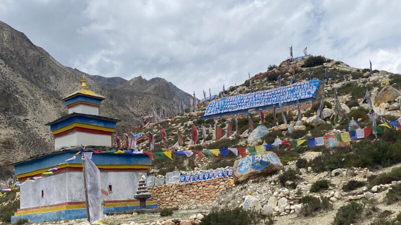
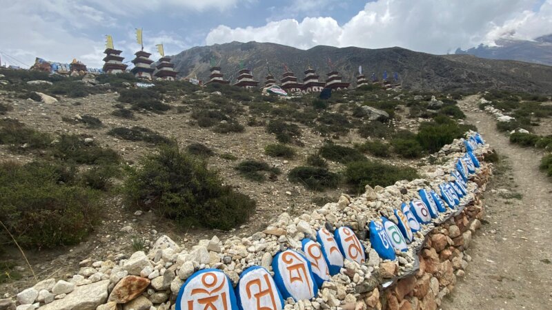
The Nar Phu Valley trek is a remote journey into a little-visited corner of the Annapurna region, reached by leaving the Annapurna Circuit. This is not a relaxed teahouse trek or a climbing trip. Instead, it leads deep into remote Himalayan valleys, where basic trails, limited facilities, and long walking days define the overall trekking experience.
This trek falls under restricted trekking regions in Nepal because the area lies close to the Tibetan border and has very few permanent settlements. Special permits and a licensed guide are required to protect the region’s culture and environment. The route follows hidden trekking routes of Nepal, where travel is tightly regulated and outside influence remains minimal.
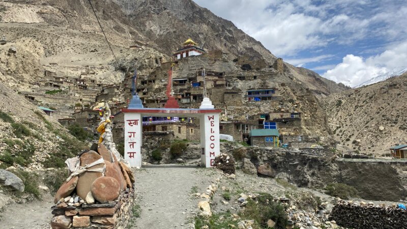
Compared to popular Annapurna trails, Nar Phu is quieter, tougher, and far less developed. Fewer lodges, higher elevations, and rougher terrain create a real mountain challenge. In return, trekkers experience an authentic Himalayan lifestyle, shaped by ancient traditions and isolation. This balance of culture and altitude clearly places it among true examples of trekking beyond Annapurna.
Nar Phu Valley Trek Itinerary (11 Days)
Show All
Day 01: Drive from Kathmandu to Koto
-
 Elevation: ~2,600 m (Koto)
 -
 Duration: 10–12 hours
Day 02: Trek from Koto to Meta Village
-
Elevation: ~3,560 m (Meta Village)
-
Duration: 6–7 hours
Day 03: Meta to Phu Village
-
Elevation: ~4,080 m (Phu Village)
-
Duration: 6–7 hours
Day 04: Acclimatization Day at Phu; Visit Tashi Lhakhang Monastery
-
Elevation: 4,080 m (hikes up to ~4,400 m)
-
Duration: 3–4 hours
Day 05: Trek from Phu Village to Nar Phedi
-
Elevation: ~3,490 m (Nar Phedi)
-
Duration: 5–6 hours
Day 06: Nar Phedi to Nar Village
-
Elevation: ~4,110 m (Nar Village)
-
Duration: 3–4 hours
Day 07: Acclimatization Day in Nar Village; Side Hikes
-
Elevation: 4,110 m (hikes up to ~4,600 m)
-
Duration: 3–4 hours
Day 08: Cross Kang La Pass & Descend to Ngawal
-
Elevation: ~5,320 m (Kang La Pass)
-
Duration: 7–9 hours
Day 09: Trek from Ngawal to Manang
-
Elevation: ~3,540 m (Manang)
-
Duration: 3–4 hours
Day 10: Drive from Manang to Besisahar
-
Elevation: ~760 m (Besisahar)
-
Duration: 6–7 hours

Day 11: Besisahar to Kathmandu
-
Elevation: ~1,400 m (Kathmandu)
-
Duration: 6–7 hours
Nar Phu Valley Route & Map Explanation
The Nar Phu Valley trek route breaks north from the Annapurna Circuit into a remote trans-Himalayan corridor. Its path follows ancient trade routes and geographic logic rather than a typical circular loop. This layout emphasizes the isolation of the Trans-Himalayan Region, moving you through high-altitude settlements and rugged, historic landscapes.
"Mapped route of Nar Phu Valley showing trail alignment, settlements, river systems, altitude transitions, and high-pass crossing"
The map highlights the full access route into the Nar Phu Valley, showing entry from Koto, the inward valley progression, and the exit over Kang La Pass. It explains how river corridors and elevation changes shape settlement patterns and daily trekking stages. The map also clarifies Nar Phu’s geographic separation from road networks and its controlled linkage with the Annapurna Circuit.
Altitude Profile & Acclimatization Approach
Altitude management is a defining factor of the Nar Phu Valley Trek. The route climbs steadily into isolated high valleys before crossing a major pass, requiring deliberate acclimatization planning. When approached conservatively, altitude risks remain manageable even within high altitude trekking experience zones.
Highest Sleeping Elevations
Sleeping elevations on this route regularly exceed 4,000 m, specifically during your stays in the ancient Nar and Phu villages. While you will reach the trek’s highest point at Kang La Pass, the trail descends quickly afterward to ensure you sleep at a safer altitude. This strategic acclimatization plan keeps overnight heights lower than the pass to minimize high-altitude risks.
Role of Acclimatization Days
Acclimatization days are built into the schedule to ensure a safe and successful journey through high-altitude terrain. These rest days are a vital part of any Himalayan trek, allowing the body to adjust naturally to lower oxygen levels.
- Allowing physiological adaptation to the thin mountain air
- Reducing AMS risk by giving the body time to recover
- Improving sleep quality for better overall rest
- Supporting energy recovery before challenging sections
- Preparing for pass-crossing milestones like the Kang La
- Enabling light activity to stay active without physical strain
Skipping these essential acclimatization periods significantly increases the risk of altitude sickness. Respecting the pace of the Nar Phu Valley trek ensures you stay strong and healthy for the entire adventure.
High Altitude Acclimatization Trekking Logic
High altitude acclimatization works best when you follow a slow and steady climb. By sticking to these gradual ascent principles, you give your body the best chance to handle the thin mountain air on the Nar Phu Valley trek.
- Climb high, sleep low by visiting higher spots during the day and sleeping at lower elevations
- Increase sleeping altitude slowly to avoid putting too much stress on your heart and lungs
- Include active rest days with short, easy walks to keep your blood flowing
- Avoid sudden elevation jumps that can trigger altitude sickness symptoms
- Monitor symptoms daily and talk openly with your trekking guide about how you feel
- Adjust pace proactively to save your energy for the big pass crossing
This smart trekking logic is the secret to safe movement through remote Himalayan terrain. Following these steps makes the journey much more comfortable and helps you reach the Kang La Pass feeling strong.
Common Altitude Sickness Symptoms
Altitude illness can happen to anyone once you climb above 3,000 m, especially if the ascent is rushed. Recognizing these common symptoms early is the best way to stay safe on the Nar Phu Valley trek.
- Persistent headaches that don’t go away with rest
- Nausea or a general feeling of an upset stomach
- Loss of appetite, even when you need energy for hiking
- Fatigue and feeling unusually tired after light movement
- Dizziness or lightheadedness while walking or standing
- Poor sleep and difficulty staying asleep at night
- Shortness of breath even while resting at the tea house
Early recognition of these altitude sickness symptoms allows for a quick response and prevents the situation from getting worse. Always keep your trekking guide informed so you can adjust your pace and enjoy a safer Himalayan journey.
Prevention Strategies
Smart prevention strategies focus on pacing, hydration, and careful observation. Following these simple steps will help you stay healthy and strong while exploring the Nar Phu Valley.
- Slow ascent to give your body enough time to adjust to the thin air
- Adequate hydration by drinking plenty of water and warm fluids throughout the day
- Proper rest days to recover your energy before reaching higher altitudes
- Light acclimatization hikes that keep you active without causing exhaustion
- Avoiding alcohol and tobacco, which can make altitude sickness worse
- Immediate reporting of symptoms to your team as soon as you feel unwell
- Conservative decision-making to prioritize your safety over reaching the summit
Having a licensed trekking guide for constant monitoring is strongly advised for this remote route. These habits turn high-altitude safety into a natural part of your Himalayan adventure.
Remote Area Safety Limitations
The isolation of the Nar Phu Valley means that immediate help is often far away. Being aware of these remote area safety constraints is a key part of planning a successful Himalayan trekking expedition.
- Limited medical access with very few health posts available in the high-altitude villages
- Unreliable communication due to weak satellite signals and a lack of mobile networks
- Weather-dependent evacuation where clouds or wind can delay emergency helicopter flights
- Few alternative exit routes because the steep canyons make turning back the only option
- Basic accommodation only in simple tea houses with minimal heating and facilities
High levels of trekker preparedness are essential when exploring such rugged landscapes. Carrying a proper first-aid kit and hiring an experienced local trekking guide helps manage these risks in the remote mountains of Nepal.
Altitude on the Nar Phu Valley Trek is carefully managed through a structured ascent and planned rest days in traditional villages. By keeping sleeping elevations lower than the day’s highest point, high-altitude safety remains a priority. This professional approach controls altitude sickness symptoms, ensuring a secure and rewarding journey through this stunning, restricted Himalayan landscape.
Landscapes, Terrain & Environmental Context
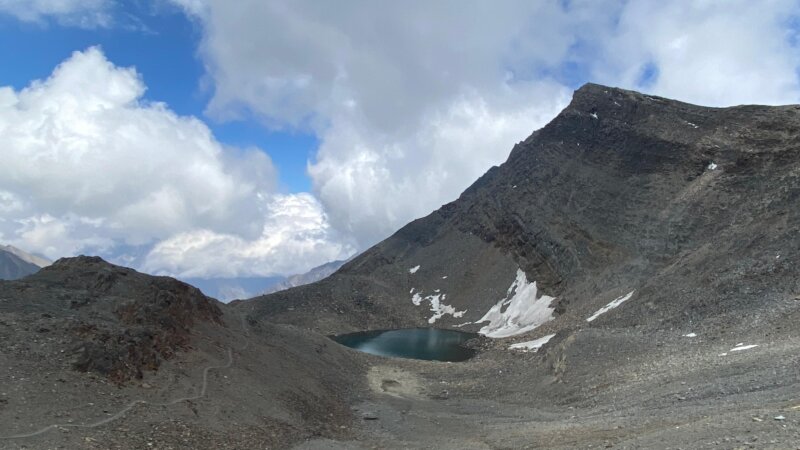
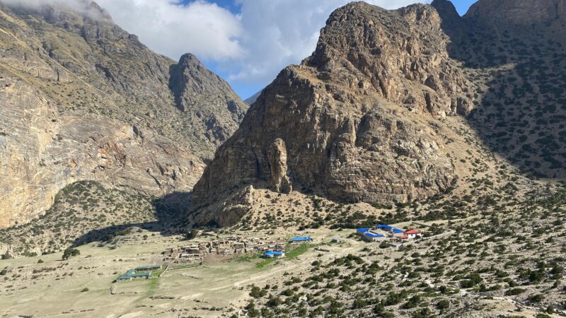
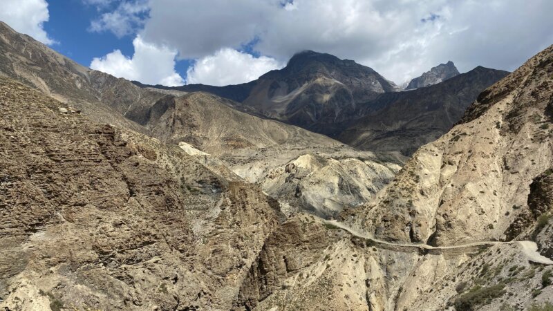
Nar Phu Valley features a stark Himalayan alpine desert, wide alpine valleys, and raw Himalayan landscapes shaped by wind, cold, and altitude. Sparse vegetation, eroded cliffs, and glacial riverbeds dominate the terrain beyond the tree line.
Eco friendly trekking practices and sustainable tourism principles are essential here. Limited resources, fragile soil, and slow ecological recovery mean responsible trekking behavior directly impacts the long-term preservation of this remote valley.
Is the Nar Phu Valley Trek Right for You?
The Nar Phu Valley Trek is designed for trekkers seeking isolation, altitude exposure, and cultural immersion rather than comfort or speed. Preparation and realistic expectations are key to enjoying this remote Himalayan journey.
- Fitness expectations: Good cardiovascular fitness is required for long ascents and consecutive trekking days.
- Prior trekking experience: Previous multi-day high-altitude trekking experience is strongly recommended.
- Preparation timeline:
- Build aerobic endurance
- Practice hiking with load
- Plan permits early
- Arrange insurance
- Review packing list
- Allow acclimatization days
- Confirm guide logistics
- Common mistakes to avoid: Underestimating altitude, poor layering, and rushing acclimatization.
Why Choose a Licensed Agency for Nar Phu Valley Trek?
Restricted access, altitude risk, and cultural sensitivity make professional guidance essential on the Nar Phu Valley Trek. Licensed experts ensure legality, safety, and respectful engagement with local communities.
Legal Compliance
Licensed operators manage all regulatory requirements.
- Permit validation
- Restricted area rules
- Group compliance
- Checkpoint coordination
- Documentation accuracy
This prevents legal disruptions during the trek.
Safety Standards
Professional systems reduce risk.
- Altitude monitoring
- Emergency planning
- Route assessment
- Weather decision-making
- Evacuation coordination
Safety is proactive, not reactive.
Cultural Sensitivity
Local expertise ensures respectful travel.
- Monastery etiquette
- Village customs
- Seasonal practices
- Religious norms
- Community interaction
This protects cultural integrity.
Operational Advantage in Restricted Areas
Experience matters where infrastructure is limited.
- Logistics foresight
- Local networks
- Crisis handling
- Trail knowledge
- Resource planning
Expert guidance turns isolation into confidence.
Plan a Safe Nar Phu Valley Trek with Local Licensed Guides
Planning a Nar Phu Valley Trek requires local knowledge, restricted-area experience, and careful logistics. Work with a government-registered trekking operator based in Nepal that operates directly in the Nar Phu region. From permit handling to route pacing, licensed guides, and on-ground coordination, everything is managed locally for safety, legality, and a smooth high-altitude experience.
If you’re ready to finalize dates, cost, or route options, send us your Nar Phu Valley Trek inquiry for clear, expert guidance. For verified availability, transparent pricing, and direct local support, contact us today and plan your trek with a licensed Nepali team. No intermediaries, no guesswork - just reliable on-ground execution!


Nar Phu Valley Trek | 11 Days Itinerary FAQs
Find answers to the most common questions about the Nar Phu Valley Trek | 11 Days Itinerary, including permits, itinerary, cost, and difficulty.
How much does the Restricted Area Permit cost for the Nar Phu Valley Trek?
The Restricted Area Permit cost for the Nar Phu Valley Trek is USD 100 per person for the first 7 days, with an additional USD 15 per extra day spent in the restricte area of Manang.
Can I find ATMs or cash withdrawal points during the Nar Phu Valley Trek?
No. You cannot find ATMs or cash withdrawal points during the Nar Phu Valley Trek. Cash withdrawal is only possible before the trek, mainly in Kathmandu or Besisahar, so you must carry sufficient cash for the entire trek.
Is there electricity and hot water available on the Nar Phu Valley Trek?
Yes, but limited. Electricity and hot water on the Nar Phu Valley Trek are available in some tea houses, usually solar-powered, often at extra cost, and less reliable at higher elevations like Phu and Nar villages.
Are there age or physical fitness restrictions for trekking in Nar Phu Valley?
No formal restrictions. There are no official age or physical fitness restrictions for trekking in Nar Phu Valley, but trekkers should have good endurance, prior high-altitude experience, and the ability to walk long hours on rugged terrain.
Can the Nar Phu Valley Trek be extended to include other passes or trails?
Yes. Nar Phu Valley trek can be extended to include other passes or trails such as Thorong La or side routes connecting to the Annapurna Circuit, depending on permits, acclimatization, and trekking duration.
Can Nar Phu Valley trekking permits be arranged after arriving in Kathmandu?
Yes, Nar Phu Valley trekking permits can be arranged after arriving in Kathmandu, but only through a licensed trekking agency, and processing usually requires passports, photos, and confirmed guide arrangements.
What happens if weather delays affect my restricted area permit dates?
If weather delays affect restricted area permit dates, permits cannot be modified mid-trek. You must adjust itinerary within valid dates or exit the restricted zone early to remain legally compliant.
Are flights an alternative to road travel for reaching the Nar Phu Valley trailhead?
No. Flights are not an alternative to road travel for reaching the Nar Phu Valley trailhead. Access to Koto is only possible by road via Besisahar and the Marshyangdi Valley.
Do tea houses in Nar Phu Valley accept cash only, or are digital payments possible?
Cash only. Tea houses in Nar Phu Valley accept cash only, and digital payments are not possible due to lack of internet, banking infrastructure, and electricity reliability in the restricted trekking region.
Are trekkers allowed to enter monasteries freely in Nar and Phu villages?
Yes, with respect. Trekkers are allowed to enter monasteries in Nar and Phu villages, but must follow local customs, remove shoes, avoid restricted areas, and seek permission before photography.